Yoho National Park in BC is only a few minutes from Lake Louise, so we decided to make it a day trip. Yoho is small (507 sq mi) and spectacular. Driving through on the Trans-Canada Highway you’re surrounded by tall, jagged, colorful, ridged mountains that jut straight up into the sky.
 Our first stop was Wapta Falls where we hiked about 3 miles with some steady uphill. The falls are big and wide. We observed them from above and then walked down to the river to see them from below. On the way back up we met a short, young French woman running down the trail. She asked us if we had seen her friends. We hadn’t. Awhile later a tall young man came striding down. He asked me if I had seen a small woman with a big camera.
Next we drove along a side road to see Natural Bridge, an interesting rock formation. It used to be a waterfall but over time water seeping through the rock carved out a bridge. Now the water flows under the bridge, which will eventually collapse and create a canyon. We continued on to Emerald Lake where there’s a resort. The lake is a pretty emerald green similar to Lake Louise but not as crowded. We started to walk around the lake. As we passed some picnic tables, I heard lots of different languages being spoken, including Spanish, Italian, Hebrew, French, German and Chinese. Then we turned back and found the trail to Hamilton Falls. In the hiking guide it is described as “a pleasant stroll” of 1.6 km and ½ hour round-trip. This is grossly misleading. This was a steep, difficult climb with switchbacks of about 2 miles. It was as hard as the Fairview hike yesterday. When you first see the waterfalls, you can’t be sure you’ve actually arrived. You haven’t. It keeps going up and up. When we finally got to the top, there was a delicate, narrow, three-tiered waterfall. It was pretty, but I’m not sure it was worth the climb. On the way down we encountered another couple going up and wondering when they would arrive. We returned to the main road, stopped at the visitor’s center and looked briefly at their fossils. I told a young ranger about Hamilton Falls, but he wasn’t sympathetic in the least and said in his opinion it was an easy hike.
 We didn’t have time to stop in the tiny town of Field tucked beside the mountain, but it looked inviting with good photo opportunites.
 We drove up another narrow road about 8 miles, stopped at the Spiral Tunnels viewpoint and also at the “Meeting of the Waters” confluence, where the murky Yoho River joins the clear Kicking Horse River.
At the end of the road, we parked and took a truly pleasant stroll on paved paths to see Takakkaw Falls. These falls are tall and impressive. You can hear them thundering from the parking lot. At our last stop, we got a closer look at the spiral railroad tunnels, which had been built in a figure 8 to change the original grade from a steep, dangerous 4.5% to the more manageable 2.2%. When we were there, we saw the end of a train entering through a tunnel above and the front of it emerging from another tunnel below it. The next day we drove west back through Yoho, worth seeing again, this time with the trailer in tow. We passed through Glacier National Park (BC) on the way to Mt. Revelstoke National Park. These two parks are actually in the Columbia Mountains.
After days of sunny weather, it started looking like rain again.
We got a campsite, had a late lunch and set off to explore.
Mt. Revelstoke Park, at 100 square miles, is even smaller than Yoho. We headed for Meadows in the Sky Parkway, a couple miles away. The parkway goes up about 15 miles to subalpine meadows. Thick clusters of wildflowers lined the road on either side as we drove up. We stopped at a few viewpoints, but by the fourth one, it started to rain. By the time we got to the top, it was pouring rain with thunder and lightning to liven things up. David started hiking the 1 km summit trail to the meadows in the rain, while I sat in the car. On the way up he met some people who said there was zero visibility. He called me on the walkie-talkie and told me. He said he couldn’t see anything and maybe he should come down. I said that’s fine, but I was going to sit in the car until the rain stopped. “How long are you going to wait? Hours?” he asked me. I said I didn’t know. I could see a small sliver of lighter sky in the distance. I hoped it would spread. David continued to the top. This was our only chance to see the meadows, and so, if I had to wait an hour or two, I would. At the top, David radioed again and said he could see a view and that I should take the shuttle up. I could see more light sky and also, the rain seemed to be letting up. I went to the shuttle stop and waited a few minutes. On the shuttle, the ranger said the flowers were peaking 3 weeks later than usual this year because of a cold summer and later snow melt. We were here for the peak! He said it had been hailing but looked like it was clearing up. In a few minutes we arrived. The rain had virtually stopped. We walked to the fire tower and got a good view of the surrounding Monashee and Selkirk mountain ranges. The landscape was fairylike with short trees, little shallow ponds and a profusion of wildflowers scattered throughout the meadows. Trails wound about with viewpoints and a few sculptures. It was enchanting. The weather improved. I could have stayed for hours just wandering about, but it was getting late. On the drive down we saw a marmot on the side of road. We stopped at the Nel Nelson ski jump, but you have to hike up to it, and although it wasn’t far, we were out of time. The next day we drove back through Mt. Revelstoke. We walked several short interpretive trails:
The Skunk Cabbage trail is a boardwalk around a wetland with lots of big skunk cabbages, which were past their time. We saw an American dipper in the creek bobbing up and down, just like the sign said it would, and a few other migrating bird species. The Giant Cedars trail went through a wet, sweet-smelling forest of old western hemlock and western red cedars. I got some photos, and then my camera battery died, and that was all the photos for the day.
After that we were out of Mt Revelstoke and into Glacier National Park, which, at 521 sq mi, is about the size of Yoho. (Compare to Jasper, which is 4335 sq mi.)
The Hemlock Grove trail took us through an ancient stand of western hemlock with a plethora of ferns. The Rockgarden trail wound through a forest with huge boulders from a long-ago avalanche. We scrambled up and over boulders and along rock steps.
The Loop Brook trail was several miles long through a thick forest, Signs interpreted the railroad and engineering feats to route trains through the mountains. I think David was relieved to be learning about something other than ecology and wildlife. Quite a few huge, tall stone trestle supports still stood, although the train trestles were long gone. We got a bit lost at one point. We’ve found that most of the trails are confusing at times because they often split, and, without directional signs, you’re left wondering which way to go.
Our next stop was at the Rogers Pass summit where the transcontinental railroad was completed. It was cold and raining. Then, a bit farther was the Rogers Pass Discovery Centre, which had the usual dead animals, a couple videos and other information. We drove an hour farther to our campground in Golden.
In the morning we drove south to Radium Hot Springs in Kootenay National Park while listening to the Eagles on the radio. They were playing all Eagles for some reason. The countryside was mainly farmland on one side and wetlands on the other.
Radium is a small resort village, like Lake Louise. We camped in Redstreak, a large park campground with confusing campsite loops set in sparse woods.
That afternoon we walked along Redstreak Restoration Trail, which takes you around an area where prescribed burns are being used to restore the prairie. One of the reasons is to provide natural habitat for indigenous bighorn sheep. After that we stopped at Olive Lake, a small, shallow, green, clear lake with a short trail. We saw some of the small brook trout that live in the lake. The road through Kootenay is very steep in places and passes through some high cliffs. The mountains aren’t as tall and jagged as in Glacier.

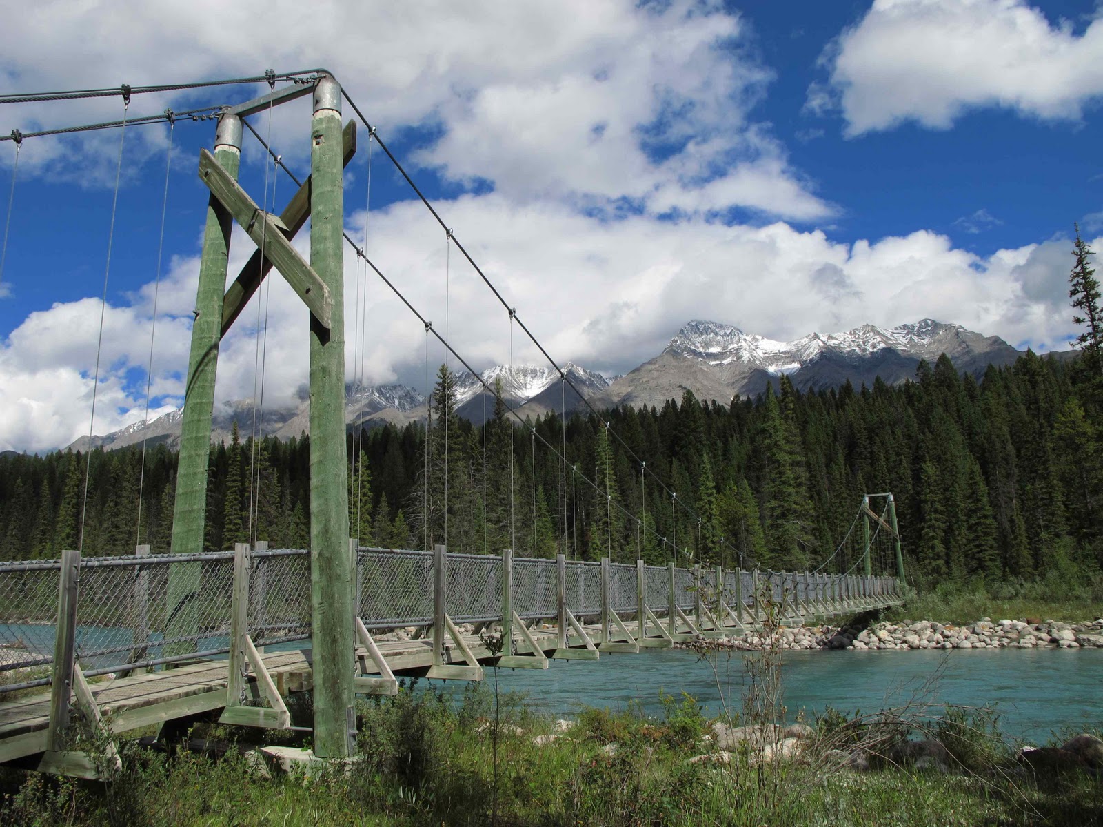
 We hiked the 4-mile Dog Lake trail. It started out flat, went through a wooded campground, crossed two suspension bridges and continued into a forest. Then it started to climb up and up and up. It was a beautiful day. A little cool in the shade, but we warmed up as we hiked. The trail just kept going up and seemed longer than indicated. Finally we got to the top and then started going down down down. We could hear loons on the lake. We finally arrived at a marsh with reeds, a pretty lake beyond it and mountains in the distance. The sun shone. Clouds drifted slowly by. We stayed a few minutes, then returned.
 On the way back to Radium, 16 miles away, we stopped to look at the hot springs for which it is known. There were two pools and several buildings. Although the source is natural, the pools themselves looked like ordinary swimming pools.
A little farther were Sinclair Canyon & Redwall Fault, interesting but not as impressive as other places we'd seen. It rained all night. In the morning, it was wet, cold and overcast. We hooked up the trailer and headed east. We stopped at Hector viewpoint and after about 50 miles stopped to see Numa Falls. I don’t get tired of looking at dramatic scenery of craggy mountains with all their variety of size, shape, color and height. The lights and shadows with their infinite dances never get old. At our next stop, the Paint Pots, the earth was orange. First Indians, then Europeans collected the ochre to make paint. Signs explain the history. We walked muddy orange paths to three small pools of colored water. Next it was Marble Canyon, a steep, dramatic canyon with a river at the bottom and waterfalls at the end, well worth the short hike. The landscape had been burned about seven years ago and still looked pretty desolate. Then we were out of Kootenay, and, after stopping at the Continental Divide, back in Alberta. The really short Fireweed Trail took us around a forest that had burned 40 years ago, and plaques explained fire’s role in the ecosystem. After that we headed straight to Banff. We were worried that the campground would fill up early because it was Labor Day weekend. We waited in line about ten minutes and then got assigned a campsite.


 Our first stop was Wapta Falls where we hiked about 3 miles with some steady uphill. The falls are big and wide. We observed them from above and then walked down to the river to see them from below. On the way back up we met a short, young French woman running down the trail. She asked us if we had seen her friends. We hadn’t. Awhile later a tall young man came striding down. He asked me if I had seen a small woman with a big camera.


 We didn’t have time to stop in the tiny town of Field tucked beside the mountain, but it looked inviting with good photo opportunites.


 We hiked the 4-mile Dog Lake trail. It started out flat, went through a wooded campground, crossed two suspension bridges and continued into a forest. Then it started to climb up and up and up. It was a beautiful day. A little cool in the shade, but we warmed up as we hiked. The trail just kept going up and seemed longer than indicated. Finally we got to the top and then started going down down down. We could hear loons on the lake. We finally arrived at a marsh with reeds, a pretty lake beyond it and mountains in the distance. The sun shone. Clouds drifted slowly by. We stayed a few minutes, then returned.


1 comment:
Nice Pict...
Post a Comment