

Our trip to Dawson was not nearly so long or fraught with danger, but it wasn’t without its challenges. We essentially began in Fairbanks, drove 200 miles to Tok, 100 miles to Chicken and 93 miles on the Top of the World highway across the Canadian border and into Dawson. Most of the road from Chicken to Dawson is dirt and loose gravel. Long stretches are steep, narrow and winding with soft shoulders (or none at all) and precipitous drop-offs. I had already gotten a taste of this kind of road in Denali and didn’t like it one bit. We had heard that at least one motorhome had fallen over the edge this year (all passengers survived). I was concerned, especially since it had been raining. A camper who had traversed the highway told us, “If it’s raining when you get to Chicken, don’t go on Top of the World highway. Just turn back.” The woman at the visitor’s center in Tok was reassuring. “He’s driving,” she said referring to David, “and he doesn’t want to go over a cliff any more than you do.”
When we left Denali, it seemed like the weather was improving. It was warmer, and the sky was almost clear. We drove to Fairbanks, 120 miles away, and, after two false attempts at finding a campground (one had no campsites left with hookups, the other had gone of business), we found a campground. Since the weather was warm, in the 60’s, and the sun was shining, we went on a bike ride.

We had to ride on sidewalks at first because of busy roads until we got on the multi-use trail, which follows the Chena river to downtown and beyond. We stopped and looked at some monuments.
 The path continued a long way, but after an hour, we turned around. The river itself isn’t particularly attractive, in my opinion, but some beautiful flowers had been planted on the trail downtown.
 We spent another day in Fairbanks visiting a few sights and running errands. We saw two male musk ox butt heads with a huge, resounding boom at the Large Animal Research Station. Evidently males don’t live as long as females because of brain damage due to this practice of theirs. The day had started out warm but, by that afternoon, it was back down into the mid-40’s and raining.

 We left for Tok the next day, stopping first at the Santa Clause House in the North Pole, which is essentially a Christmas store. We stopped at several turnouts and learned about the various gold rushes, saw an impressive view of the Alaska range and looked at the Alaska pipeline extending across the Tanana river.
 We walked around Rika’s Roadhouse, which Rika ran for years in the early to mid 1900’s, catering to prospectors and locals.

 At the Delta Junction visitor center, we got the obligatory photos of the end of the Alaska Highway marker and the big mosquitoes. We drove through a lot of permafrost areas with dwarfed black spruce. We saw a mother moose and her baby, but when we slowed down, they quickly disappeared into the forest.
The last time we were in Tok in the same campground, David rotated the tires and plugged a leaky tire. This time he adjusted the brakes of the trailer tires because they weren’t responding properly. He had to raise the trailer to do this. He had a hard time because they were gummed up, so he had to disassemble the hubcaps.

 In the morning it was cold, cloudy and rainy. As we turned onto the Taylor Highway leading to Chicken, the landscape was mostly stunted black spruce forest. A lot of it had been burned in 1994 and still not recovered. Sometimes the burned part was on both sides of the highway, sometimes on just one side. There were acres and acres and mile after mile of black, burned stick trees against a dull grey sky. It was kind of surreal. The road wound up and down. Few cars were on it at first. It rained harder, so we passed the turnouts I had planned to stop at and didn’t go on a short trail. It was freezing cold, well, actually it was in the mid-40’s. Cold enough. Traffic increased. The road was paved at first with rough patches and quite a lot of road construction. A few miles before Chicken, the road turned to gravel.
 At Chicken we looked at parts of a gold-mining dredge.
Then we went to “Downtown Chicken”, which is essentially one business with several stores and a gas station.
 We got 7 gallons of gas to top off the tank. There were a couple campgrounds and an old intact dredge. We looked around and then continued on our way.
In the morning it was raining and cold. We left around 8:30. I remembered the woman who said not to go on Top of the World if it was raining. The cold just made it worse. It meant that I might get hypothermia while clinging to the side of a cliff we had just fallen over. The descriptions of the road in my guidebook only made matters worse: “EXTREME CAUTION: Steep climb on narrow road as highway ascends. Limited passing room, soft shoulders and long drop-offs make this a dangerous stretch. If in doubt, STOP for oncoming traffic: Do not risk a tip over by putting a wheel into the soft shoulder!”. David said he wasn’t worried about it and had no intention of falling over a cliff.
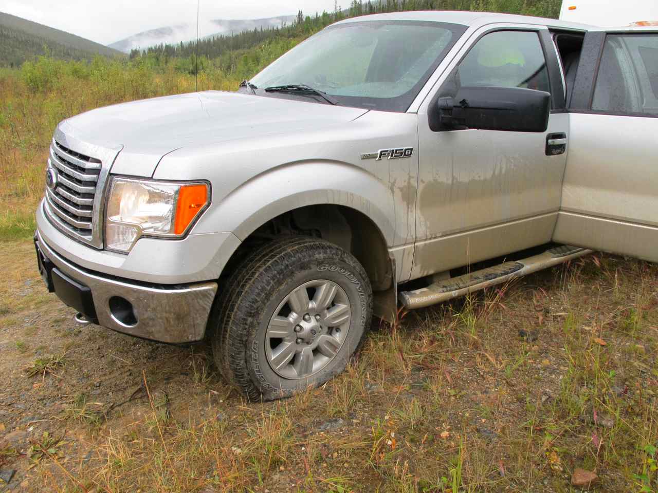
 The road we were on had recently been graded, meaning that not only was it gravel, it was freshly-exposed gravel with big sharp rocks sticking up. Within 10 miles, the flat tire alarm went off right before we were about to ascend the particularly steep, narrow, dangerous section of road described above. David stopped the truck and got out to look. He rushed back in and said we had seconds to pull off the road. There was a pullout just ahead but it had a deep dip.
 We tried to get into it and got most of the trailer off the road before the tire went completely flat. David tried to plug the tire, but the hole was too big, so he changed it with our only spare. It took about an hour. During that time, I considered that perhaps we should turn back to Tok where we might get the tire fixed. We were about to go on the steepest, narrowest, most precarious part of the road. What if we got another flat between here and Dawson? We didn’t have another spare. We couldn’t pull off the road. People may not even be able to pass us. We had just gotten two flats within ten miles. The road back to Tok wasn’t easy, but once we got past Chicken, it was paved. I made the suggestion to David. He considered it and then decided we should take the chance and forge ahead. He was afraid of getting another flat but didn’t like the prospect of backtracking. He decreased the tire pressure from 45 to 35 psi to make the tires less susceptible to flats. It continued to rain.
 Then it got foggy and colder. It got down to 40o. The tire alarm kept going off because it wasn’t connected to the new tire, so David stopped to check the tires every ten or 20 miles. So here we were on a narrow, steep, winding road with soft shoulders, hairpin curves and no guardrails, where one small, false move might find us tumbling to our deaths over a steep cliff. To make matters worse, visibility was poor, and if we had a flat, we would be stuck. “Uh, remind me why we’re doing this,” I asked David. “Is this fun?” Fortunately when we had to pass someone coming the other way, it wasn’t at a spot that was too narrow. We got higher, and it got foggier. The highway is known for its scenic views. For awhile we couldn’t see very far. When we could see, it was mostly black spruce stick trees scattered about a rolling mountainous landscape of olive green willow bushes. It was a bit surreal or science-fictiony, especially in very foggy patches. We had about 90 miles to drive this day, often at 20 or 25 mph. Oncoming cars, oil trucks and even a few tour buses passed by. A couple tour buses led by a pilot car passed us and helped flatten out the gravel in the road. The cats were unhappy, perhaps because they could feel our agitation or maybe because the road was so bumpy. Neptune complained incessantly. At one point I gazed down an especially steep cliff on my side of the road and imagined us falling over it. Then I stopped that thought so as not to attract it.
 The road we were on had recently been graded, meaning that not only was it gravel, it was freshly-exposed gravel with big sharp rocks sticking up. Within 10 miles, the flat tire alarm went off right before we were about to ascend the particularly steep, narrow, dangerous section of road described above. David stopped the truck and got out to look. He rushed back in and said we had seconds to pull off the road. There was a pullout just ahead but it had a deep dip.

We didn’t stop at most of my planned stops. When we got to the Canadian border, we were asked some questions and waved on through. In Canada there were intermittent sections of pavement. The gravel didn’t bother me as much as the drop-offs, which didn’t bother David. The rough gravel patches bothered him. Finally Dawson was only a few miles away.


 We stopped at a rest area with a viewpoint and a “Welcome to Dawson” sign. Then we got to the ferry, the last obstacle between us and Dawson. David had read that vehicles with low clearance could have a problem, so he was concerned about our being able to get on the ferry, but there was no way we were turning back! We got there at 3:23 pm and were first in line. The ferry was on the other side, loading up. But it didn’t take long for it to fight the strong current over the Yukon River. We got on quickly without a problem. By 3:43, we were across. It was still raining slightly. We went to a campground a little ways out of town, registered, set up and by 5:00, we were in for the night. Made it.


 We stopped at a rest area with a viewpoint and a “Welcome to Dawson” sign. Then we got to the ferry, the last obstacle between us and Dawson. David had read that vehicles with low clearance could have a problem, so he was concerned about our being able to get on the ferry, but there was no way we were turning back! We got there at 3:23 pm and were first in line. The ferry was on the other side, loading up. But it didn’t take long for it to fight the strong current over the Yukon River. We got on quickly without a problem. By 3:43, we were across. It was still raining slightly. We went to a campground a little ways out of town, registered, set up and by 5:00, we were in for the night. Made it.
2 comments:
that sounds harrowing. I was very nervous for you. Brenda
Sorry your trip across the Top of the World Highway was not the best. We drove the same route in Sept 2001. The road from Chicken to the Canadian border was the worst road we have ever traveled and we do a lot of back road driving. But once back in Canada the road was excellent. It was a sunny evening and the drive was one of the highlights of my life..three mountain ranges visible in an unending vista and the road ahead glimpsed as it wound over the mountain tops. We only saw one vehicle during the entire drive and the complete absence of any sign of human habitation or activity was amazing. For me it was truly on of the great wonders of the world. We went on to drive north out of Dawson City on the Dempster Highway as far as the Arctic Circle....now that was a drive !!!!!
Post a Comment