

In Saskatoon, the biggest town in Saskatchewan, we went to the Museum of Western Development, which has an indoor prairie streetscene depicting “ 1910 boomtown”. An entire street is represented with all the “businesses” you would have found, complete with buildings, (fake) horses and carriages, (fake) people, fire truck, furnishings and items of the time period. All it needed for authenticity (besides replacing “fake” with “real”) was mud and sunlight. (It was indoors with poor lighting.)

There was also an assortment of antique tractors and cars, a wind power exhibit and a dinosaur skeleton. David was keenly interested in the tractor collection, which pretty much showed its evolution.

 He said, unlike a car, you can easily see all the workings of a tractor on the outside. The museum also followed a typical family from when they immigrated to the province in the late 1800’s through historic events, including the Dust Bowl and the Depression, down to the present day. As you can imagine, it took several hours to see.
 We went to the Berry Barn to taste Saskatoon berry pie. David said it tasted like blueberry pie, just not as sweet. I thought it tasted rather pasty and gummy. It may be an acquired taste.

 Downtown is located along the South Saskatchewan river. We rode bikes on the Meewasin Valley trail, which follows the river through town. Lots of other people were out walking and biking. One of David’s tires was wearing out, so he had to take it easy. The following day he went to a bike shop and bought a new tire. The campground we were staying in had lots of voracious mosquitoes.
 From there we visited Batoche National Historic site where the Métis fought a decisive battle with the Canadian military for their rights in 1885. They lost.
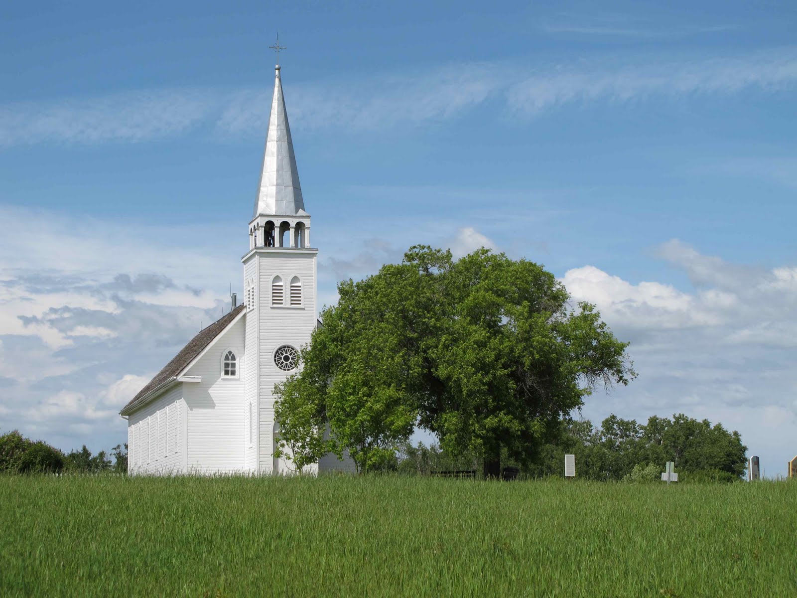
This site was way off the beaten path. To get there you drive through pretty, green, rolling prairie dotted with ponds. Each pond has a few ducks. Homesteads are few and far between. When we were ready to leave, the GPS wanted us to retrace our steps back to the highway. Looking at the map, I could see it was shorter if we continued on. The GPS wasn’t happy with this decision and kept telling us to turn around. Before long, David was also uncomfortable with our course mainly because we were towing the trailer. “But I can see where this road intersects the highway,” I said. Then the road turned to dirt. I didn’t have a very detailed map, but if I looked closely, I could see that part of it was unpaved. “Only a few miles,” I said. We came to the point where we were supposed to cross the river. There wasn’t a bridge, just a tiny, platform ferry. “We can’t go on that,” said David. “Okay,” I said. “Just keep going. In a few more miles you’ll come to a bridge. Also, it becomes paved again.” The road got more narrow. “There’s nowhere to turn around anyway,” said David. After eight miles of dirt, the road did become paved.

After several more miles, we came to a narrow railroad bridge. Trains no longer used it. So we did get across and on our way to Prince Albert National Park. Good thing it hadn’t started raining yet. We would have been driving through mud. As it was, I thought it was fun.

Prince Albert NP is a lot like Riding Mountain NP in Manitoba. There’s a little town on a lake inside the park. The forests are mostly spruce and aspen, with their Tiddlywink leaves. Both parks have resident bison. We spent a couple days hiking and driving through the park.
We saw our second black bear, several elk including a mama and baby strolling through the campground and a few deer, but we didn’t have time to take the 4-hour round-trip drive to see the bison.

The day we arrived it was pouring rain, but the rain let up enough so that we were able to take a few short, soggy hikes in the woods that afternoon and drive on one of the main scenic roads. The next day was beautiful, sunny and warm so we drove on another scenic road and hiked on a couple trails.


 The scenery was pretty, but the mosquitoes were vicious, and the trails were muddy in places. The rain soon returned but not before David got in a bike ride on a muddy, difficult trail with horse flies that bit him through his shorts. It poured rain all night.
The next day it rained most of the day but let up long enough for us to visit Fort Battleford where the Royal Canadian Mounted Police had an outpost from 1876 to 1924 to enforce Canadian law and oversee the Indian treaty signed in 1876.

The First Nations in Manitoba and Saskatchewan had lived on the bison for centuries, but by the 1870’s, the massive herds were close to extinction, and European settlers were arriving in droves. The Indians had no choice but to sign treaties and agree to farm. However, the Canadian government didn’t uphold their end of the bargain, and the Indians faced starvation and disease. Violent uprisings erupted. Like the Métis, the First Nations eventually lost. The Métis were descendants of French traders and Cree women. They had their own culture and language (Michif). They, like the Indians, were marginalized and discriminated against. The people of both groups suffered years of mistreatment, poverty and discrimination, just like native people in the U.S.
We stayed in WalMart that night. It poured rain all night.
3 comments:
Too bad you can't send some of that rain our way. The weather folks are complaining about no rain. Brenda
Saskatchewan Isn't usally soggy, its usally very dry just this spring was very wet.
Hm...I heard that Saskatchewan is one of the best wild travel destinations. A friend told me that is a real pleasure watching the sunset in this area, and this made me think about going on a trip there very soon.
Post a Comment