September 3-7
Banff is a resort town (as well as a national park) overflowing with tourists, especially on a holiday weekend. We had only one day to see it and the vicinity.
It was a cold, clear morning. We set off to see nearby lakes and other points of interest.
Cascade Ponds is a pleasant lake in a pretty setting. We spent a few minutes looking at it and went to the next stop.
 |
| Johnson Lake |
The temperature warmed up as we walked less than 2 miles around emerald-green Johnson Lake nestled among the mountains.
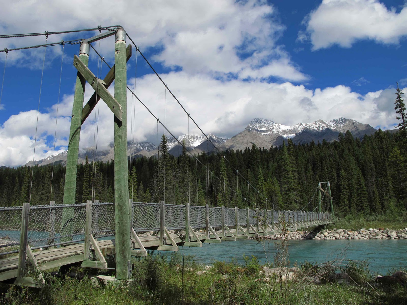
Minnewanka lake is big and popular. People were walking, picnicking, boating and hanging out on small, pebble beaches. We followed the lakeshore to the Stewart Canyon trail, which led us through woods to a bridge over a river running through the canyon.
An interpretive trail led us through the now-abandoned coal-mining town of Bankhead. Very little is left of the town, but its history is interesting.
We returned to the trailer, had lunch, then drove through thick traffic into town. Mobs of people sauntered about. We figured many were from Calgary, which is only about 80 miles away. The town is cute and chock-full of shops. We overheard a ranger joke that the most popular tourist activity in Banff is shopping.
We walked near the Cave and Basin National Historic Site, the location of warm mineral springs, but it was closed for renovation. We visited the Banff Park Museum National Historic site, an old wildlife museum of dead wild animals collected over a century ago.
After that we went to Bow Falls. It was so crowded we had trouble finding a parking spot although the parking lot was huge. The low falls quickly turn into rapids.
We tried to visit Banff Springs Hotel National Historic Site, but it was so snarly, we couldn’t find a place to park. We got a quick look at the outside of the hotel.
It turned into a beautiful, sunny day in the high 60’s. Everywhere we went, lots of happy people were out soaking up the sunshine on bikes or on foot.
We stopped to take a quick stroll around Cascades of Time Gardens with its pretty flowers.
Then we went to get gas. It took awhile just to cross the small town because of congested traffic. The gas station was so crowded that we left to find another one, couldn’t find one and ended up back at the same station in a long line. One of the pumps wasn’t working, and they didn’t accept credit cards. So we waited and eventually got gas.
The next day we drove south to Calgary. It was Sunday, and lots of people were driving north, presumably headed to Banff. The Rockies started fading away. Soon we were in rolling hills and pastureland. Then it got flatter and more prairie-like. As we neared Calgary, we noticed a great deal of new construction, with acres of new developments, new roads and interchanges. We learned later that fracking (or hydraulic fracturing, a means of natural gas extraction through deep wells) is creating a huge influx of people because of the jobs it’s creating in the area. The GPS got a little confused by all the new roads and had a hard time finding the campground.
No one was in the office so we picked an empty site. The Internet worked great for once. We went to CostCo, which was a few miles away. The parking lot was so crowded, we had a hard time finding a place to park. We went to PetSmart to get the cats a new scratching pad and stopped at a grocery store. Back at the campground we washed clothes and got the cleanest, driest clothes we’ve had since the start. The campground was very quiet during the day. After 5, people starting coming home from work. Most people were living there permanently although many seemed gone for the holiday.
With our errands out of the way, the next day we were free to sightsee in Calgary.
This was a glorious day, warm and clear, one of the warmest days we’ve had. We went downtown and looked for the visitor’s center, but for some reason, couldn’t find it. We drove around several times, saw some “?” signs but couldn’t find the center. We stopped to look at the Family of Man statues, which are tall and thin and looked rather more like aliens to me. We drove by a festival and tried unsuccessfully to find a parking spot.
 |
| Lougheed House |
So we went to look for the Devonian Gardens. We found a metered parking spot, but weren’t sure whether we had to pay on a holiday. I went to investigate while David sat in the car. I walked one way and then another. I couldn’t find an address, so I went into a nearby building. It was a huge, upscale mall with 4 floors and a big skylight. People were wandering around. I found the directory and discovered that the gardens were on the 4th floor. I tried the elevator, but it wasn’t working. The escalators weren’t lined up so I had to walk around looking for the way up. I finally found where the gardens should have been, but they were being renovated, so there was nothing to see. I got us sub sandwiches for lunch, which we ate in the car. We were parked under a pedestrian pass, so it was like being in a tunnel. After that we went to the Lougheed house. It was closed, so we walked around its small, formal rather underwhelming garden.

We ended the day at Pearce Estate Park, which has trails around a wetland area and the wide Bow river beside the highway. Lots of people were out picnicking on the lawns and floating down a small set of rapids.
All in all we were unimpressed by Calgary, but possibly we just didn’t have enough time to discover its charm. Downtown seemed clean and tidy and has attractive big buildings, a few parks, and some interesting-looking hangouts and markets that we didn’t have time to investigate. As we drove back to the campground through urban sprawl and numerous high-density developments, we could see a multi-use trail. When we got back, David put his bike in the truck and went on a bike ride while I worked on the itinerary for the rest of the trip.
The next day we left the campground and drove 80 miles to Bar U Ranch National Historic Site, which interprets the history of ranching in Canada. We looked at the exhibits, watched a short video, then walked through the buildings, which are spread out in a ranch setting. It was a hot day in the high 70’s. Some of the buildings had exhibits; others had interpreters. A woman was singing in the cookhouse. She had made delicious oatmeal-fig cookies.
The smithy was stoking the fire. It was smoky inside because the “civil servants” had built the chimney wrong. We had an interesting conversation with him. Among other things, he said taxes, especially on gas, are way too high in Canada.
Next we tried to lasso a “cow”. It took me about 5 tries to get half a horn. David got it in about 3 tries. (Maybe he’s missed his calling?) The cowboy instructing us had been a 5th generation rancher but when the BSE or mad cow disease was found in Canada, the US stopped importing beef from Canada for a time, and Canada couldn’t consume enough of it by themselves. As a result, many ranchers went out of business.

We looked at the Percheron horses, then sat at a campfire with another interpreter who talked about camping on the range and fed us fresh bannock (fried bread), a traditional food. After that we were ready to return and, along with 4 other people, got into a wagon pulled by 2 Percherons. Instead of taking us back to the visitor’s center, which is what I had expected, the driver took us far off into a field beside a stream, stopped, and proceeded to talk to us, a captive audience. I was horrified and annoyed that he was delaying us against our will. I started sneezing non-stop. He asked me if I was allergic to horses. When I said yes, he told me to move to the back of the wagon, which I did. It seemed to help, and I stopped sneezing. We must have been on that wagon 45 minutes before getting back.

So we were way behind schedule and had another 2 hours to drive to Waterton Lakes National Park. It was a pretty drive through rolling, bumpy hills covered with golden grasses. You could see the Rockies in the distance. At one point there were dozens of windmills, maybe to take advantage of the Chinook winds. Cows and horses grazed here and there, but mostly it was empty. Closer to Waterton there were more trees and bigger bushes. The mountains were fairly low, without snow, all bare rock and quite picturesque.
We finally arrived around 6, passing lots of small lakes as we drove in. No one was there to register us, and it was a bit confusing to figure out where to camp, but we found a vacant site. It was crowded, surprisingly so, since it was after Labor Day. The campground was a large, nondescript, grassy area next to a pretty lake with a mountain view.

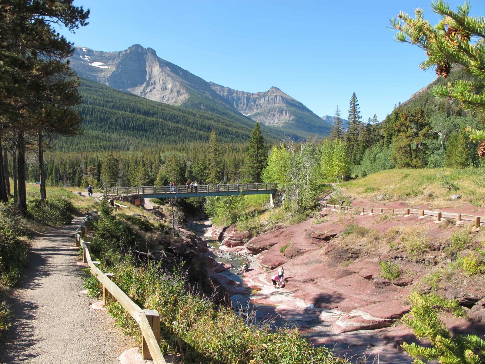
We had only the following day to see the park. Fortunately, it’s small, and it turned out to be a warm, sunny, windy day. First we went to pay, but no one was in the kiosk, so we went to the visitor’s center to get information on the park. There was a relief map of the park, but not much else. Then we drove the narrow, winding 9-mile, scenic Red Canyon parkway, stopping at several turnouts and viewpoints. It was striking how the prairie and mountains merged. At one stop there was a plaque about bears. A couple in another car were looking through binoculars at some nearby hills. I scanned the hills and eventually saw a mother grizzly and her cub. They were probably eating berries, but they were pretty far away.
At the end of the parkway is the ½-mile Red Canyon trail. We hiked along one side of the steep, narrow, very red canyon and then the other.
Then we hiked about 1.5 miles to see pretty Blakiston falls.

On the way back to the campground we stopped at the Prince of Wales hotel with its dramatic hilltop setting. A deer walked into some bushes in front of the hotel. When I looked, another large deer was lying in the bushes. Since they’re not hunted here, they probably feel its better to be annoyed by tourists than eaten by predators.
Back at the campground I returned to the kiosk to pay. The ranger asked me if I had left her a note. There had been no instructions about leaving a note! She said someone else had registered in our spot last night and wanted to know if anyone else was in the spot. (There was room for only one camper in a campsite.) I said no. She asked me several times! Obviously there wasn’t anyone or we wouldn’t have been there! The system wasn’t letting her enter the information, so I asked if that meant we got a free night. “NO!” she barked emphatically giving me a mean look. She took my money.
After lunch we drove across the tiny town to Cameron Falls, which are right beside the road. Then we checked out the Peace Pavilion, which commemorates the peace agreement and cooperative nature between Waterton and adjacent Glacier National Park in Montana.
Then we drove the Akamina parkway, another 9-mile, narrow, winding road but steeper than the Red Canyon parkway and not as scenic because the trees lining the road obscured the views.
We stopped at the First Oil Well in Western Canada National Historic Site, which had some informative plaques and a tripod.
 |
| Akamina Lake |
At the end of the parkway is a large parking lot and Cameron Lake, where a few people were out on small boats. We walked a short trail to Akamina Lake, a small, pretty lake bordered on one side by a bright green marsh. It seemed very quiet and peaceful. Then we walked along Cameron Lake a few minutes, read about the ecology of the area and returned to town. We stopped at the gas station and used the rest of our Canadian dollars to buy gas. A few people were windsurfing on Waterton lake, benefitting from the Chinooks.
We weren’t able to see everything the park has to offer and could have stayed another day or two, but we had seen enough and were ready to return to the US.


 On the way back to the campground we stopped at the Prince of Wales hotel with its dramatic hilltop setting. A deer walked into some bushes in front of the hotel. When I looked, another large deer was lying in the bushes. Since they’re not hunted here, they probably feel its better to be annoyed by tourists than eaten by predators.